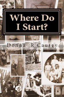
FROM TENNESSEE TO TEXAS—THROUGH ALABAMA
The 1860 Diary of William Joseph Camp Edited by William R. Snell
(Transcribed from The Alabama Historical Quarterly, Vol. 44, Nos. 01 & 02, Spring and Summer 1982)
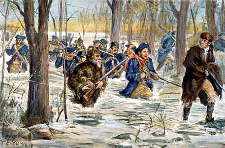
In the fall of 1860 over 20 residents of Chatata Valley (Bradley County, Tennessee) decided to emigrate to Grayson County, Texas. The group consisted of three families, a family slave, and her three children. Sixteen days of their two-month trip were spent traveling through North Alabama and present an observer’s impressions of some of the people and communities of the area on the eve of the Civil War.
The senior members of the move were William and Margaret Cowan Camp and their five children: Sterling, 24, John Lee, 21, William Joseph, 19, Archibald, 17, and their only daughter, Margaret E., 14. They were accompanied by their oldest son, James, 27, and his family: Susan Lay Camp, 25, their daughter, Darthula, 1, and the wife’s sister, Miny Lay, 17. Their two-year-old daughter, Mary E., may also have gone with the son’s family.
Each member of the Camp family had been born in Tennessee, and was listed in the 1850 and 1860 census records. In 1850 William Camp had real estate valued at $4,250. By 1860 his real estate was valued at $9,000, and his personal property was appraised at $12,000. He was financially much better off than many of his Bradley County neighbors. Archibald and Margaret had attended school in 1860.
Anderson and Malinda Coleman and their six children were the third family to make the journey. This family, with their oldest son, were listed in the 1850 census. Ten years later they had five additional children, all born in Tennessee. In 1860 the family included Anderson, 38, Malinda, 36, Patterson, 11, Isam (male), 9, Sarelda, 7, Rebecca, 5, Nancy, 3, and Arby, a six-month-old daughter. Mr. Anderson held real estate worth $1,000 and $200 in personal property according to the 1860 census. The three oldest children had attended school in Bradley County.
Mrs. William Camp had suffered a stroke six weeks after bearing their daughter, so a slave, Aunt Ruth, was purchased to help her. Aunt Ruth and her three children—the only slaves the family ever owned—made the trip to Texas with the family. There were at least 23 members in the migrating party. Joseph, our 19-year-old diarist, was the fourth son of five born to William and Margaret Camp. He had been born March 21, 1841, in Tennessee.
Reflecting his agricultural background, Joseph wrote of land, crops, stock, slaves, mountains, valleys, water, traveling conditions, and distances. For a person so young, he was a good observer. He recorded his impressions of the villages, towns, and cities along the route. He was impressed with internal improvements, especially the railroads and steamboats. Several fairs were in progress as they passed. Noticeably absent are references to God or religious observances, as were references to many members of their entourage.
Reminiscent of early frontier humor, we chuckle at references to a still, and possible rascality (Sept. 30). A broader grin greets the episode of Mr. Keller, who priced his “fine stock” beyond reason (Oct 1), and the antics of gizzardless Mr. Mills, the opportunist, who created an income over his self-made, impassable stream (Nov. 16).
DIARY OF WILLIAM JOSEPH CAMP
September 20, 1860.
Today, being a pleasant day, we concluded to start on our journey to Texas. We began at about 12 and all our teams performed very well. After bidding our friends farewell, we pursued our journey about three miles and encamped at Hayes Camp or Pull-tite, where we enjoyed our first night in fine spirits.
Sept. 21. This morning found all of us well and everything passed off very well. We came to the beautiful town of Cleveland situated on the East Tennessee & Georgia Railroad where we halted some three hours on business, after which we continued our journey without any trouble. After traveling 10 miles, we pitched our tent in a beautiful grove in Blax Fox Valley near what is called Tucker’s Chalybeate Springs. This valley along the Cleveland & Chattanooga Railroad lies well, and from its general appearance will produce wheat and corn in great abundance.
Sept. 22. This morning we got a very good start and traveled without much difficulty through the extreme southwest corner of Bradley County and down Hurricane Creek. After traveling about 15 miles, we camped near the state line. The journey wearied us and our stock because of a very bad road through White Oak Mountains.
Sept. 23. This morning found us rolling out of Tennessee into the state of Georgia. Five miles of travel over a beautiful road brought us to the town of Ringgold, Georgia, situated on the state railroad. Ringgold, containing fine houses, a small business section, and about 1200 inhabitants, is situated in a very good country. Here we crossed the Chickamauga River and passed up Pea-vine Valley, where we saw the best corn that I have seen this season. After driving about 20 miles on a very nice road lying on the west side of Taylor’s Ridge, we camped for the night at a small opening on a farm belonging to a man by the name of Lowery.
Sept. 24. After taking a good night’s rest, we rose and prepared to leave. After breakfast we continued our journey. Today we traveled over some of the nicest country that I ever saw, although it is mostly of thin soil. We found some very good land on the Coosa River and two other small streams, which was the limit of good land seen today. We saw a good many cotton fields, and from what I know about cotton growing, I would guess that it is too late to yield a good crop. We also saw a great many gin-houses and cotton presses which is a right smart curiosity—to a person raised in East Tennessee. Late in the evening we came to the small town of Summerville, which is well situated for a large town, having a large spring rising on the west side and flowing through the north part of town. With no connection with any other place by railroad, and surrounded by much poor land, the town has never grown very large. After driving 20 miles, we pitched our tent for the night, about one mile south of town.
Sept. 25. This morning we got a very good start and traveled without any trouble along a very good road. [The Alabama state line was about 10 miles southwest of Summerville.] The day’s journey is mostly down the Chattooga River, where we found very good land, and plenty of kinky heads [slaves] out picking cotton. These were the only people seen today except at a small place called Gaylesville, Alabama situated on the west side of the Chattooga River. After traveling about 23 miles, we camped for the night on the west side of the Chattooga River.
Sept. 26. This morning found us in very good spirits. We geared up and continued our journey without any trouble. Six miles along the road brought us to a small place called Blue Pond, so named because of a large pond, which has been sounded to a depth of 450 feet without finding bottom. This town is made of a small grocery, a stage stand, and a wagon shop. One mile from Blue Pond we reached the foot of Lookout Mountain, which is about half a mile high and had the roughest road that I have seen on my route. With all hands to the wheels and a good driver, with some difficulty, we got all wagons upon the mountain safe and sound. After about 12 miles we camped upon the mountain near an old acquaintance of father’s by the name of Brindley.
Sept. 27. This morning we were on the road again by eight o’clock, and three miles of driving brought us to the turn of the mount where we went down. When we got about halfway down the mountain, I heard a powerful rumbling and roaring above me—something similar to distant thunder or an earthquake. There then broke into a scream for help— unsurpassed by the voice of Tecumseh—from a hack driver, who could be distinctly heard 7 miles away.
Sept. 27 continued. The hack driver’s knees came into collision with my “dadies” side of the wagon, and broke about five of the wheel’s ribs. The driver went over, his collar bone came in contact with a sand rock, which left a considerable piece of skin on the rock. As good luck would have it this was the only flesh wound made during this exciting time. All of this confusion was, nothing more nor less, than the overturning of the hack, with rig and wooden leg in it. After the hack was replaced, we passed on to a place called Van Buren, consisting of a square formed by horse racks, -a doctor shop, and tin shop. About 3 o’clock we came to the foot of Sand Mountain, where we got some mountain water, and by applying manpower to the wheels, as heretofore, we got upon the mountain with less difficulty than was expected. After traveling 15 miles we camped on Sand Mountain near an old gentleman by the name of Williams, who sold us corn for our stock by us claiming to be all for John Breckenridge and Joseph Lane [the Southern Democratic candidates]. That night one of our mares got loose and attacked another in battle, during which they both were badly hurt.
Sept. 28. We were all well except the old man who was scarcely able to travel from the wounds he received yesterday when the hack turned over. The day’s journey was on the top of Sand Mountain. The sand, in some places, is very deep and pulled our horses tighter than any previous day since we started, consequently we traveled only 12 miles today and camped on the same mountain.
Sept. 29. Three miles travel brought us safely to the foot of the mountain. Two additional miles brought us to Warrenton, situated at the foot of Raccoon Mountain. We stopped here to take a snack of dinner at a large spring flowing out of the south side of the town. Here we found a widow on her way to Texas. She had been detained here several days, because her children were sick. Her name was Turner, from Hamilton County, Tennessee, who was on her way to Red River County, Texas.
After eating our dinner and letting our horses cool, we found that one of our mares was not able to pull up the mount, from a wound that she received the night before last. Fred Carrins, a man who was traveling with the widow, offered us the service of his mule to pull up the mount. By accepting his favor we got up the mountain very easily. After driving 15 miles, we camped on Shoal Creek with the intention of staying here until Monday.
Sunday, Sept. 30. The morning was very pleasant so I concluded to take a small excursion down the creek to see if I could discover anything. Everything seemed desolate and discouraging until I came to the creek, when all my imagination and wonder were aroused by one of the most sublime scenes that ever came before my eyes. In the first place, the water seemed to be as pure as ever came out of the ground, and was as clear as a crystal. Secondly, it broke over a natural dam of rock about four feet high. After rustling over the rocks, which broke its course some 20 feet, it made a perpendicular fall over a rock of about 15 feet. Down under this was a house— I suppose was built for a still, and from its appearance—I would not be surprised if there was rascality carried on at this place. From hereon down, as far as I examined it, the water ran almost unperceived under the large loose rock, which looked like a pile of ruins. About 12 o’clock Mrs. Tuner came up with her teams, and, having an extra mule, she proffered to lend it to us, so that we might drive off the mountain into the valley where provisions were plenty. Provisions were scarce where we were. After rolling out, a 7-mile drive brought us to the foot of the mountain at James Julian’s place, where we found everything that could be wished for by a company of emigrants. Provisions were plenteous and as low as any we had bought previously.
October 1. This morning we found that our mare was still not able to travel. Some of us set out on a squirrel hunt while others struck out to buy some beef. As regards the squirrel hunt, we failed to kill any, but as far as the beef was concerned, we got plenty of good meat by paying 31/2 and 4¢ per pound for it. This morning an old gentleman by the name of Keller came down the mountain and said that he had some fine stock to sell. We told him to bring it down as we thought that he could sell it. In the evening he brought down three or four old, gray horses. His horses were one-eyed, crooked-legged, hip-shotten [worthless], and sway-backed, but the old man flattered himself that they were fine horses, so he priced them according to his own feelings. He went back satisfied that we did not think much of his stock. Next we tried to get some sweet potatoes to eat with our beef. Some of the boys struck out over the mountain for that purpose. After walking about 10 miles, they landed back, with skinned feet and aching bones—without getting any- potatoes.
Oct. 2. Today we stayed at Julian’s. It rained occasionally consequently we did nothing but lay in tents and wagons.
Oct. 3. This morning it was still raining, and we put off starting until tomorrow. At about 12 Jim McCarty and Bordin passed us. Late that evening a train of movers from Cobb County, Georgia passed us on their way (to Smith County, Texas. The company consisted of 100 people, white and black, and 17 wagons.
Oct. 4. This morning it was still raining, but by twelve it looked like it was clearing off. We rolled out and traveled about 5 miles and camped in a large swamp. The country that we traveled over this evening was surrounded almost entirely by mountains, but was some of the best land that I ever saw. It was heavily timbered and mostly low land.
Oct. 5. This morning we continued our journey and found a very rough road. It is a swampy area with the road made with a causeway [a raised roadway]. A 15 mile drive brought us to Somerville, Alabama, situated on the side of a hill, having for its foundation almost a solid limestone rock. There was nothing grand about this place. It is nothing more than a cotton-country village. The most complete building that I saw was the jail, which is a large brick house picketted in with posts 12 feet high, and has an iron cage in the side of the wall. From the appearance of the inhabitants, I would think that it was just such a house as was needed in that place. After driving 20 miles we camped for the night at the White Oak Springs.
Oct. 6. This morning found us on the road again. Four miles travel brought us off a very rough mountain called Limestone Mountain. Once off the mountain we found fine roads through beautiful cotton country. In the evening we came to Decatur, Alabama, situated on the south side of the Tennessee River. Decatur seems to have been a very busy place at some past time, but it is on the decline at this time. The most beautiful sight was when I came in sight of the railroad bridge across the river at Decatur. Just as I was viewing the bridge the passenger car entered it and passed through. We halted in Decatur a few minutes and a tremendous rain fell for about 15 minutes. Today we drove about 15 miles and camped a mile west of Decatur in a small glade.
Oct. 7. This morning we rolled out again without much trouble and found beautiful roads but a scarcity of water. Late in the evening we came to a nice little village called Courtland, situated on the Stephenson and Memphis Railroad. After driving 20 miles we camped about one mile west of Courtland.
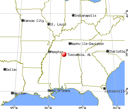
Oct. 8. This morning we continued our journey and found some very good roads and fine country, but the water is neither plenteous nor good. About noon we came to a small railroad town called Leighton. After traveling 23 miles over a wealthy portion of Alabama, we camped about one mile east of Tuscumbia.
Oct. 9. This morning we geared up and started our journey. After about a mile, we came to Tuscumbia, which is a very old place, built in the old style. The fairgrounds at Tuscumbia were beautifully situated on a small creek west of the town. We had tolerable good roads today, but by being bothered with the [railroad] cars we drove only 12 miles.
Tuscumbia, Alabama
Oct. 10. This morning we were on the road again, and 7 miles of travel brought us to Buzzard Roost, where we bought some feed for our stock. We continued our journey over broken country and took dinner at Thompson’s toll bridge on Bear River [Creek]. This evening we had a very hilly road to travel. We crossed the line out of Alabama into Mississippi. After driving 20 miles we camped for the night on Cripple Deer Creek.
Oct. 11. We rolled on towards Jacinto, Mississippi this morning. Late in the evening we came to Jacinto and found the roads to be very rough and hilly. We passed but few houses today, and found feed and water to be very scarce. After driving about 20 miles we camped 3 miles west of Jacinto at a spring that does not run—made by sinking a gum in a pond and calling it a spring.
Oct. 12. This morning found us on the road to Rienzi, and with 2 miles of travel we entered the Tuscumbia Swamp, which is about one mile across. We found, on the west side of the swamp, a fairgrounds, with the fair going on. We did not go into this fair, but I saw a great deal of their stock and it is very sorry. At this place they are at work on the Mobile and Ohio Railroad, and the cars will be running at this place by Christmas. A few hundred yards brought us to the town of Rienzi, which is a very flourishing little place. We continued until evening and crossed another turnpike over Hatchey Swamp, which is about one mile in length. After driving over 23 miles of rough road, we camped for the night on Ten-mile Creek.
Oct. 13. After a few miles we came to a beautiful little place called Ripley. Today we traveled about 20 miles and pitched our tent on Tippak Creek with the intention of staying until Monday.
Sunday Oct. 14. Today we enjoyed ourselves by gathering grapes, muscadines, hazelnuts, and chestnuts.
October 15. This morning we continued our journey and after traveling 11 miles we came to a small country place called Salem. We drove 21 miles over hilly, sandy, dry country.
Oct. 16. After traveling 5 miles we reached Holly Springs, Mississippi. This is a considerable place built upon a city style and has some splendid buildings that would compare favorably with most any place in the United States. The state fair commenced this morning and the streets were crowded with people, horses, buggies, omnibuses, and cotton wagons. We drove 18 miles.
Oct. 17. We drove toward the Mississippi River. First, we passed through a small place called Wall Hill, and about 5 miles distant, we passed through Buck-Snort. We drove 18 miles today.
Oct. 18. This morning we traveled early and passed through a small place called Taitesville. We traveled today in Coldwater bottom, and found the roads to be very good. We crossed Coldwater at Mathew’s Ferry. After driving 25 miles we camped for the night on the west side of Coldwater River.
Oct. 19. We rolled out tolerably early this morning, because we had to drive in the swamps. We crossed Black Walnut Bay at Mathew’s Bridge. After driving 15 miles through the swamp, on a very rough, but not muddy road, we camped for the night on the bank of Lake Flour.
Oct. 20. This morning we got up to see a lake afloat with ducks and white cranes. Ned Simmons killed 2 ducks at one shot. Just as breakfast was over, 3 strangers came up, who said they had nothing to eat, nor money to buy anything. We divided what little we had with them and rolled out again for Helena. After traveling a few miles, we approached the Mississippi River, almost the king of all rivers, the second largest in the world; it is about l11 1/2 miles across at Helena. The first steamboat we saw was the “Belfast.” We crossed the river in a steam ferryboat and reached Helena, Arkansas, which was a nice little town. We drove 20 miles today.
Oct. 21. Today we got a late start, drove 18 miles through the swamp, and pitched our tent near a gum spring that tasted very strongly of copperas [copper].
Oct. 22. We had a beautiful road all day. We drove about 20 miles and pitched our tent on Lake Pleasant with the intention of trying to get quarters to winter in Arkansas, as the reports from Texas are that people cannot get bread to eat in that state.
October 23—November 2 [a period of 11 days]. We were situated on Lake Pleasant as above stated. We had a fine time in riding upon the lake as we were shooting ducks, squirrels, water-turkeys, and wild turkeys. This lake is about 12 miles long at this time and 100 yards across, but in the winter season, I learned that the White River overflows and a part of its current runs into this lake. On the opposite side of the lake, it is almost a solid canebreak from the lake to the White River. In this wilderness, so the people tell me, there are turkey, deer, panthers, and bears in great abundance besides the great amount of other smaller game that an old hunter would not notice. We saw none of these animals, but as for turkeys, we killed 3 and saw several more.The surrounding country about this lake is very wealthy—the land is good. The corn and cotton is very good this season, but water and health are very bad.
Nov. 3. We rolled out from Pleasant Lake. We had tried to rent houses from everyone in this country but failed to get them. Several miles travel brought us to Clarendon, situated on the east side of White River. It is a low and filthy little place, and I understand, that in the time of the overflow, it is all covered with water. They have had a disease that is similar to the cold plague, which has carried a great many of them over to Davy Jones [death]. We crossed White River at this place and found a tremendously muddy road from the river to Rock Roe Bayou. After driving 12 miles, we camped for the night on the west bank of the bayou.
Nov. 4. After three miles on the road, we reached the edge of Grand Prairie, where we were to find a farm belonging to James Moore, a man with whom we made contact while staying at Pleasant Lake. We were to make a contract with him to build him a couple of houses, so that we might stay in them until spring. After we reached the farm, upon inquiry, we found that the farm did not belong to Mr. Moore and also found it contrary to what he represented it. Being disappointed by not getting any houses, we all set a firm resolution to roll on to Texas and risk the consequences. Before us lay a plain that extended as far as a man’s eye would let him see. We saw nothing else the balance of the day except fire out on the prairie which is a common thing this season of the year. After driving 16 miles we camped for the night on a ravine.
Nov. 5. This morning found us on the road again and we saw nothing but a few deer and prairie hawks skimming over the prairie. We met a couple of men who were after a man who had stolen a horse a few miles from Brownsville. In the evening we passed through Brownsville, a small town situated upon the western side of the prairie. After driving 16 miles, we camped for the night on the edge of the prairie.
Nov. 6. We were on the road again and found a very muddy road all day. We drove 20 miles and camped on the east bank of the Arkansas River in sight of Little Rock.
Nov. 7. This morning we crossed the river and found 5 steamboats, lying at the wharf, which came up the river in the spring. The waters got so low they could not run. We found a drove of 1400 head of sheep from Missouri on their way to Texas. I found Little Rock to be a very nice place. There are some fine buildings and a great many business houses. We had a very rough road and a cold rain all day. After driving 20 miles we camped for the night on Hurricane Creek.
Nov. 8. The road was very wet and muddy. After a few tniles drive, we reached a small place called Benton, which seemed to be a very nice little town, though of recent origin. We crossed Salem River and had a very rough road. After traveling 20 miles we camped for the night on a small creek.
Nov. 9. Today we had a hilly road, and before noon we came to a streak of country that had just been visited by a tremendous tornado that tore all the timber up by the roots. We passed in sight of Rockport, a small town situated on the Wachita River. After driving 22 miles, we camped on the banks of the Wachita River.
Nov. 10. This morning found us on the road again. We got along tolerably well until evening when “Sterl” [Sterling] stepped out of the wagon to a rock and put his ankle out of place. We traveled 20 miles.
Nov. 11. We had a very rough road over piney hills all day. Our stock was very stupid today, and we pitched our tent before night on the bank of the Antoine River. Today we drove 18 miles.
Nov. 12. We first passed through a little place called Antoine. We had a very good road and got along fine. After driving 19 miles, we camped for the night on a creek half a mile from Murfreesboro.
Nov. 13. We passed through Murfreesboro, a little, one-horse town. With two miles of travel we crossed the Little Missouri River, and we had a very steep hill to pull, after which we had a very good road the balance of the day. Late this evening we came to Center Point, which has some very good buildings, but scattered too much to make a nice place. After traveling 18 miles, we camped one mile west of Center Point,
Nov. 14. About daybreak, a thunder cloud came up, and it rained a very hard shower. After the rain ceased, we rolled out again, and had a very hilly road until we struck Salem bottom, which was very muddy. After we cross the Salem River, we came to a salt lake, where were some old salt works. We drove 20 miles today and camped on the prairie hills on the farm of Sam Henry, who was an old friend and acquaintance.
Nov. 15. We concluded this morning to lay over and rest our stock. It set to raining this morning and rained all day. We moved our women and children into a large shop, where they rested very comfortably. The balance of us stayed in the wagons.
Nov. 16. This morning we bade our friends farewell with a promise that they would be in Texas before long. Within two miles we struck Little River bottom and found it very muddy. We crossed the river at Mill’s Ferry. Mills is a man who has neither heart, soul, nor gizzard. He felled trees and stopped up a very good ford and ferries his neighbors free gratis in order to charge movers a high price for crossing in an old decayed boat. After we got out of the bottom, we had a very good road the balance of the day. We drove 15 miles.
Nov. 17. This morning we had a fine road. Within about 7 miles, we came to a little place called Rocky Comfort. It is composed of a grocery store stand, and a horse mill. Two miles from Rocky Comfort we came to the line of the Choctaw Nation [Oklahoma] and here found a squad of Choctaws who seemed to be in a desolate condition. I saw several large, robust Indians who had nothing in the world but blow guns and the britch clout [breechcloth] they wore. This evening we struck the bottom prairie and had mud up to the axel tree for about 7 miles. After driving 15 miles, we camped for the night on the Jones farm, one of the largest and richest farms I had ever seen.
Sunday Nov. 18. We traveled 6 miles through the Red River bottoms. We crossed the Red River at Boice’s Ferry, [entered Texas], and had fine roads the balance of the day. After driving 17 miles, we camped on a farm belonging to a man by the name of Pope.
Nov. 19. We reached the prairie, which is made up of what they call black waxy land. When wet is is awful to stick but when dry it is hard as limestone. We traveled very well and passed through Clarksville, a very nice little village. After driving 22 miles, we camped 3 miles west of Clarksville. Nov. 20. We continued our journey through the prairie and had very good roads. We saw a great deal of fine land. After driving 20 miles we camped on a creek with, the expectation of having a rough night. Nov. 21. This morning we rolled out again after having a cold night. After 8 miles we came to the town of Paris, a beautiful town situated on a large prairie. We found upon inquiry that we had to go 20 miles further before we can find wood and water. We had a fine road over the prairie and night came and still we could see no timber ahead. We drove until about 2 hours into the night before coming to a house, where we bought wood to cook our suppers. We drove 30 miles today. [This was the longest day’s journey on the trip.]
Nov. 22. Upon waking this morning we found the rain pouring down and the wind blowing. There was no wood to make a fire. We fed our stock and rolled out for the timber without eating any breakfast. One mile brought up to a little place called Honey Grove. After another 4 miles, we came to a small shirt of timber where we pitched our tent until tomorrow. [This was the last entry in the diary.]
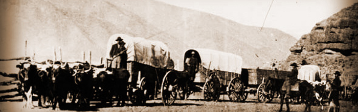
The caravan reached Grayson County, Texas, on Sunday, November 25, 1860, after a journey of slightly more than two months which covered approximately 900 miles. The family had gone west to find peace and land. While the clouds of war soon engulfed them in their now distant dwelling place, some found peace sooner than others.
Margaret Eveline Cowan Camp, the paralyzed mother, died June 1, 1861, and is buried near Denison, Texas in a family cemetery. Nearby is interred Joseph Camp, the boy-diarist, who died of fever March 23, 1862. Life was taken from him shortly after arriving in Texas and just two days after he became a man (March 21, 1841—March 23, 1862). William, the patriarch of the migration, died December 3, 1866. He was buried along side his wife. He had been born November 16, 1809, and was 57 at the time of death.
While the family had made the journey to avoid the uncertainties of “the impending crisis” of the Civil War, John Lee Camp enlisted in Captain Jim Wood’s Cavalry Company (Confederate) at Sherman, Texas in February, 1862. He was honorably discharged at Melissa, Texas, May 24, 1865. Later he married Jamima Lay on March 19, 1866. A fellow traveler on the great trek, Jamima bore him four children.
Archibald Camp became a cowboy and made trail rides into Mexico, and eventually died in Mexico City. John Camp became a farmer and orchard keeper. He helped build the first school, known as the South Gale School, on the corner of his land. A number of the family’s children attended this school, which was disbanded in 1952. John died May 18, 1931, at age 92.
Margaret married Jack McKnight, a druggist in Savoy, Texas. Later they removed to Dalton, Georgia, where she died in 1922.
After Sterling Camp served in the Confederate Army, he married Nancy Caroline Henry (of Blount County, Tennessee). The couple moved to near Bowie, Montague County, Texas, where they had seven children and spent the remainder of their lives. Sterling died September 26, 1919, and was followed in death by Caroline on August 2, 1924. They are buried in Oak Hill Cemetery on land taken from the corner of their property.
A copy of the diary was furnished by Mrs. Arthur Morgan Foster, Box 1296, Bristow, Oklahoma, 74010, who would be pleased to learn additional information about the Camp and Cowan families.
Tapestry of Love: Three Books In One – a historical fiction novel about the heritage of the Cottingham family who eventually settled in Bibb County, Alabama ca. 1818.
REVIEWS
The exhilarating action & subplots keep the reader in constant anticipation. It is almost impossible to put the book down until completion, Dr. Don P. Brandon, Retired Professor, Anderson University, Anderson, Indiana
This is the first book I have read that puts a personal touch to some seemingly real people in factual events. Ladyhawk
Love books with strong women…this has one. Love early American history about ordinary people…even though they were not ‘ordinary’…it took courage to populate our country. This book is well researched and well written. Julia Smith