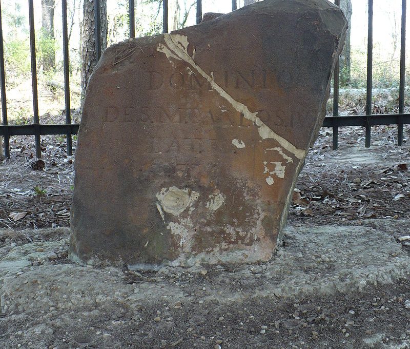
Ellicott’s Stone was originally set to mark the East/West boundary line between the US and Spanish West Florida in 1799. (US and 1799 was carved on the north side and Carlos IV (the king of Spain) on the South side.
The Stone was set with much care and pretty precisely. The survey party then proceeded East Along the 31st parallel (the agreed upon boundary) but errors either in calculation or astrological observation caused them to gradually drift to the South. By the time they got to the Chattahoochie they were about 2 miles South of the true parallel. Because of the dearth of Stone in that country (always wondered how far they had to lug the Elliott stone) they dug pits and mounds every mile as mile markers. The line has been called “the mound line”. (Some if these mounds have recently been rediscovered by archeologist)
After the war if 1812 with the first Creek land session a government public land survey was needed to subdivide the session lands so it could be sold to settlers.
Ellicotts Stone was used for the point of origins for this new public land survey (named the “st Stephens system” after the territorial capital, though this was not the stone’s original purpose.
When they ran the “base line” (east west) for the system they were a little more accurate and thus discoverd the error in the mound line. Since the mound line was already marked on the ground and accepted by treaty as the international border and later the border between Alabama and Florida they did not move the political border to the more accurate line. Thus a little sliver of Alabama was surveyed on the Tallahassee system.
All other land in Alabama Sourh of the “freeman line” (e-w line that splits Bibb county is surveyed off Ellicots Stone.
The land north of the freeman line is surveyed off the Huntsville system which was supposed to use the 35th parallel as a base line. (This line is not all that accurate either)

 Unlock with Patreon

The Ellicott Stone, separating AL from Spain on the Florida line
Jerry Smith Thank you Jerry, the link was just to some pay site. now I can google the Ellicott stone and read all about it. I hate these teaser posts
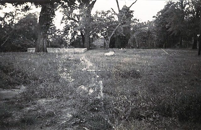
Me too, especially those who want me to shut off my ad blocker.. I’ve been to this site. You have to walk through a half mile trail to reach it.
Ellicott’s Stone was originally set to mark the East/West boundary line between the US and Spanish West Florida in 1799. (US and 1799 was carved on the north side and Carlos IV (the king of Spain) on the South side.
The Stone was set with much care and pretty precisely. The survey party then proceeded East Along the 31st parallel (the agreed upon boundary) but errors either in calculation or astrological observation caused them to gradually drift to the South. By the time they got to the Chattahoochie they were about 2 miles South of the true parallel. Because of the dearth of Stone in that country (always wondered how far they had to lug the Elliott stone) they dug pits and mounds every mile as mile markers. The line has been called “the mound line”. (Some if these mounds have recently been rediscovered by archeologist)
After the war if 1812 with the first Creek land session a government public land survey was needed to subdivide the session lands so it could be sold to settlers.
Ellicotts Stone was used for the point of origins for this new public land survey (named the “st Stephens system” after the territorial capital, though this was not the stone’s original purpose.
When they ran the “base line” (east west) for the system they were a little more accurate and thus discoverd the error in the mound line. Since the mound line was already marked on the ground and accepted by treaty as the international border and later the border between Alabama and Florida they did not move the political border to the more accurate line. Thus a little sliver of Alabama was surveyed on the Tallahassee system.
All other land in Alabama Sourh of the “freeman line” (e-w line that splits Bibb county is surveyed off Ellicots Stone.
The land north of the freeman line is surveyed off the Huntsville system which was supposed to use the 35th parallel as a base line. (This line is not all that accurate either)