This amazing journal helps us visualize this historic journey down the Alabama River in 1814 Day three on August 13, 1814
(Continued)
Over the next few days, we will follow the day by day journey of the first survey of the Alabama River which started on August 11, 1814. With this journal, we will be able to visualize the sites and experience how long this historic journey took back in 1814.
(Transcription from Transactions of the Alabama Historical Society, Volume 2, 1898)
SCROLL DOWN TO READ STORY
Proceeded at half past 5 O’Clock
N° 40 Wt 20 ch—Improved on the left
N° 80 Wt20 ch—Bluff to the right & 2 springs
S° 45 Wt 30 ch—Bluff contd on the right—a large Improvt on the left on very rich land
S° 65 Wt 30 ch—Improvt on the right—Spring on the left at the end of distance
West 1 Mile—passed an Island to the right—a creek from the right at 20 ch
S° 60 Wt 40 ch—passed to the right of an Island & a spring opposite
S° 10 Wt 40 ch passed to the right of an Island improved
S° 30 Et 20 ch contd along the improved Island
S° 10 Et 30 ch lands good on both sides
S° 30 Wt 40 ch Improvt on the right

S° 35 Wt 1 M. 20 ch. A branch from the left at 20 ch—low, flat, bottom land on the right—a little higher & rich on the left —a branch from the right at 40 ch. another from the left at 1 Mile
S° 60 Wt 10 ch. to a bluff on the left with rocky banks the river 80 yds wide here— It is generally from 150 to 200 yds wide.
N° 80 Wt 1 Mile 20 ch—passed along the bluff 20 ch to an Island & through the channel on the right—lands high on the left—rich bottom on the right & a spring opposite the lower part of the Island.
So 70 Wt. 20 ch. Chue, sa, be, ku, or the Holy Ground, 1 a bluff on the left bank of the river about 40 ch. long—It is a high bluff of level hickory, oak & pine land of tolerable good quality—a part has been cleared, but not cultivated as it was only used as a place of revelling by the war party. On the opposite side the lands are exceedingly rich and contains a fine field for cultivation.
Site of Holy Ground, a Creek Indian settlement in present-day Lowndes County, Alabama ca. 1930 (Alabama Department of Archives and History)
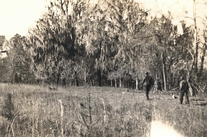
A, mo, ha, te, jah, the prophet killed at the time Gen1. Claibourne & Col. Russel attacked the place, lived at the upper end of the Holy Ground—He was joined at this place by Hillishajah (Josiah Frances) or the Mad-Physic, another prophet, and by their Prophesies & influence the party was collected & embodied, and placed under the command of W. Weatherford. a halfbreed, and others, for the attack & distinction of Fort Mimms, near the Cut off, which was effected.
N° 30 Wt 60 ch Spring on the left at 20 ch .
North 60 ch a fine spring on the left near the commencement, and a handsome bluff—fine lands opposite—passed to the right of an Island
N° 5 Et 40 ch Bluff continues & thin land on the left the whole distance—Rich lands on the right—small improvt. on the right, near the end
N° 45 Wt 20 ch. Bluff2 ends on the left & commences on the right—High & Piney lands on the left rich
West 20 ch.—Bluff contd on the right—spring branch to the right & rich lands on the left
S° 30 Wt 1 Mile along the bluff (say 150 feet high, perpendicular) passed to the left of an Island at half distance—fine rich lands on the left, a small creek3 from the right at the end of the bluff above the Island—fine rich land below the creek— rich high land on the left opposite the Island
S° 50 Wt 60 ch passed to the left of an Island 20 ch rich lands on both sides—low bluff on the left & lands high & thinner than those on the right.
N°. 80 Wt. 1 M 60 ch A field to the right on rich land—good on the left—passed to the left of an Island.
No. 65 Wt. 30 ch rich on both sides to the upper end of a bluff on the right
S°. 45 Wt. 30 ch along the bluff4 on the right
South 30 ch. Bluff continues on the right rich farming lands on the left—small creek to the right at 10 ch—bluff ends at the creek5—good lands below
S°. 10 Et. 60 ch Bluff to the right for a short distance—bluff bears off from the river and leaves a slip of good lands on the margin—very rich on the left.
S°. 30 Wt. 30 ch Rich lands on both sides6
S°. 20 Et. 20 ch.—The same
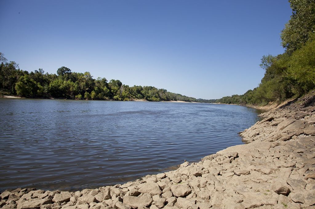
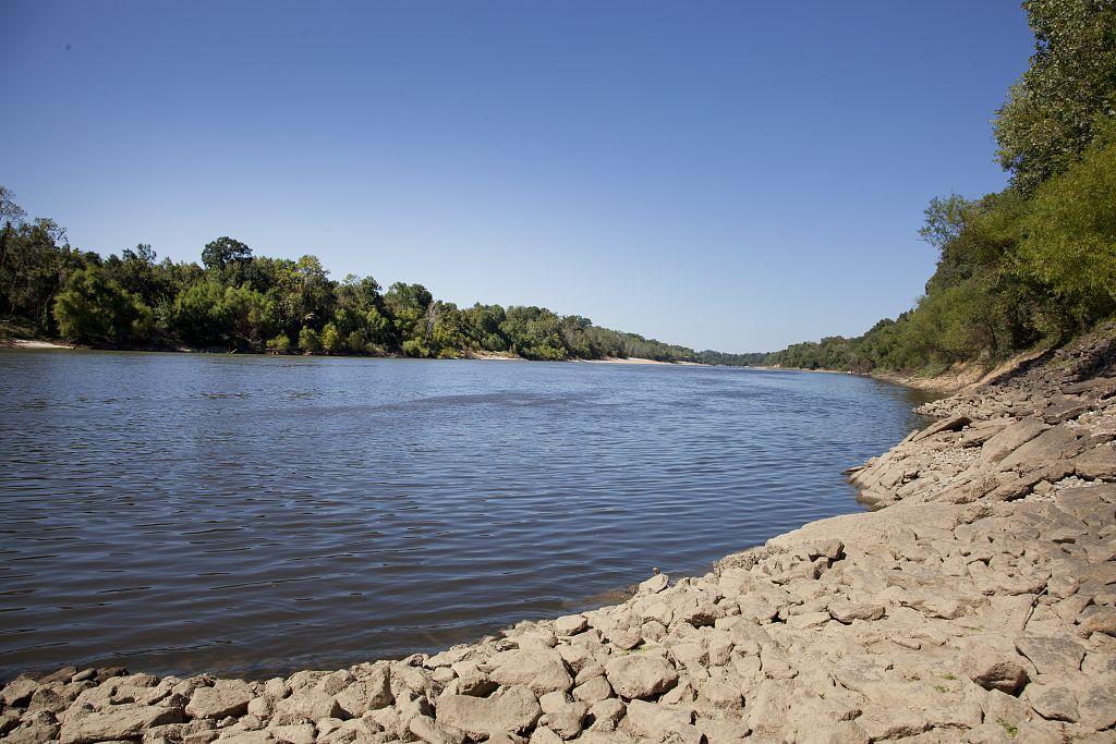
Alabama River, Monroe County, Alabama (Carol Highsmith, 2010, Library of Congress)
S°. 30 Et. 1 Mile—High lands on the right of Pine, Oak & hickory growth—Rich bottom on the left— good land commences, also, on the right at 30 ch & continues.
N°. 20 Et 1 Mile—Good lands on both sides
S°. 10 Wt. 40 ch. lands good on both sides
S°. 30 Wt. 2 Miles 40 ch. Good lands on both sides continues the whole distance—field to the right at the end.
S°. 50 Wt. 40 ch Improvement on the right contd.
S°. 70 Wt. 20 ch.—
West—20 ch. an Improvement on the right
N° 80 Wt. 20 ch Improvt. contd. on the right
N°. 65 Wt. 40 ch—Passed the mouth of Pil-loop, loc, co, or Big-Swamp Creek7 at 20 ch from the left—field still continues on the right.
N°. 30 Wt. 40 ch. Field continues on the right—good lands on the left to this point—The large Improvt. on the right is Wau, be, gus, kee old Town8—A creek from the left one mile below Big-Swamp Creek, lands thin on the left near the lower end of this distance—a small branch from the right
N°. 10 Wt 1 Mile Improvt. on the right still continues—passed to the right of an Island at half distance—Improvts. on the right cease at the upper end of the Island at the end of 3 W. & 20 ch. from its commencement. Good lands on both sides on the last course & distance
N°. 10 Et. 20 ch Improvt. on the right—lands high on the left with pine
N°. 35 Et. 20 ch—Bluff on the left—Improvt. contd. on the right—bluff Rocky with pine, Oak & hickory growth
N°. 40 Et. 40 ch bluff contd. half distance good lands from thence on both sides—fine spring on the right bank at the end.
North—30 ch—Mostly along a bluff on the right—good lands on the left—a branch on the right near the end—Here the bluff commences.
N°. 30 W. 1 Mile—corn field on the left
N°. 40 W. 40 ch A creek or branch from the right—passed a small Island.
N°. 5 Wt. 50 ch to the lower end of a sand bank on the right— passed a creek from the right—corn field on the left.
Indian sign was discovered at the corn field, supposed of the war party
Encamped on the Sand Bank for the night at 29 Miles 40 chains
1Here occurred the battle of December 23, 1813, when General F. L. Claiborne defeated Weatherford and burned this strong-hold. It was over this bluff that Weatherford leaped his horse Arrow and escaped. Tradition makes it quite a feat, while modern iconoclasts declare the bluff but ten or twelve feet high. Tatum calls it “a high bluff,” but then he saw it in August when the river was low, and Weatherford cleared it on December when the water was high and the bluff was not. For description of the “Holy Ground” sec Halbcrt’s “Creek War Incidents,”
2House Bluff.
3Beaver Creek.
4Jones’ Bluff.
5Ivy Creek.
6These references are to the fine lands on both sides of the river from Jones’ Bluff to Benton.
7In Lowndes County, also called Letohatchee, flowing into the river at or near Benton.
8Still called “Old Town Creek.
ALABAMA FOOTPRINTS – Volume I – IV: Four Volumes in One (Volume 1-4)
SAVE – BUY ONE GET ONE FREE! The first four Alabama Footprints books (listed below) have been combined into one book, Alabama Footprints – Volume I-IV –
ALABAMA FOOTPRINTS Exploration
ALABAMA FOOTPRINTS Settlement
ALABAMA FOOTPRINTS Pioneers
ALABAMA FOOTPRINTS Confrontation
From the time of the discovery of America restless, resolute, brave, and adventurous men and women crossed oceans and the wilderness in pursuit of their destiny. Many traveled to what would become the State of Alabama. They followed the Native American trails and their entrance into this area eventually pushed out the Native Americans. Over the years, many of their stories have been lost and/or forgotten. This book (four-books-in-one) reveals the stories published in volumes I-IV of the Alabama Footprints series.