UncategorizedThe beginning of Alabama occurred with a proclamation January 23, 2025 January 23, 2025by Donna R Causey To view this content, you must be a member of Alabama Pioneers Patrons's Patreon at $2 or more Unlock with PatreonAlready a qualifying Patreon member? Refresh to access this content. Tags: Alabama historyIndiansNative Americans
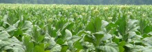
AUTHOR SUNDAY – Just reading about this makes me tired – tobacco farming was hard work! August 11, 2021 September 25, 2021
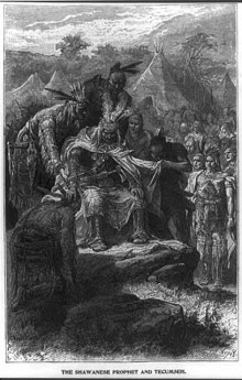
General Sam Dale gives eyewitness account of Shawnee Chief Tecumseh’s visit to Alabama in 1811 September 17, 2022 September 16, 2022

 Unlock with Patreon